Geological Risk Prediction System Based on a Tri-coupled Intelligent Model
Data–knowledge–physics integration for subsurface characterization
Nov 2023 – Dec 2025 · project; paper under review
Led a four-student project connecting geological data governance, 3D numerical modeling, cave segmentation, and seismic inversion through a data–knowledge–physics framework.
Research team lead
Geological modeling · 3D perception · Seismic inversion
Research question
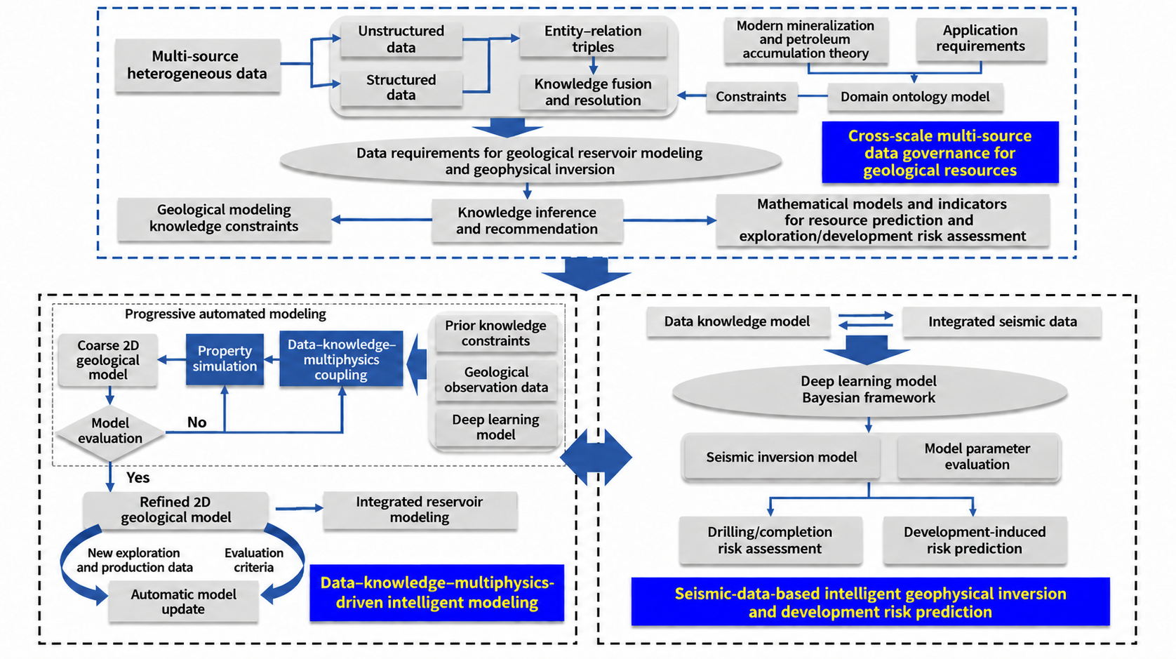
Subsurface risk assessment requires a coherent picture of geological structure from heterogeneous observations. I led a project organized around data, geological knowledge, and physical constraints, connecting data preparation, numerical modeling, intelligent target detection, and inversion. GSCD-Unet is the cave-segmentation component within this broader system.
My contribution
- Led the four-student team, set the technical direction, coordinated module dependencies, and organized project reporting.
- Directly developed the 3D geological modeling and underground-target detection components, including synthetic data generation, segmentation architectures, training, and visualization.
- Guided teammates working on multi-source data cleaning, resampling and alignment, as well as Bayesian and semi-supervised seismic inversion.
Technical approach
- Connect well, seismic, and production-related data through a common preprocessing and alignment workflow.
- Generate geological structures and synthetic observations under geological and physical constraints, then use the paired data for model development.
- Combine 3D target detection with elastic-parameter inversion as complementary descriptions of subsurface geometry and properties.
Results & outcomes
- Completed the project report in December 2025, bringing data governance, numerical modeling, target detection, and inversion into a coordinated research workflow.
- Produced a reusable geological simulation and deep-learning codebase. The cave-segmentation study led to the manuscript “3-D Seismic Detection of Paleokarst Cave Using Neural Networks with Efficient Edge-aware Downsampling and Composite Loss,” currently under review.
3D geological modeling
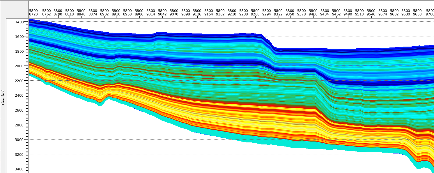
I developed a framework for batch generation of geological structures and numerical data, combining prior geological knowledge with parameterized structures and physical simulation. Fault geometry, dissolution-body scale, and noise settings provide controllable variation for numerical experiments.
The workflow produces paired seismic volumes and voxel labels. Documented experiments use 256³ volumes and 128³ training crops, connecting the modeling task with supervised 3D perception.
Cave segmentation · GSCD-Unet
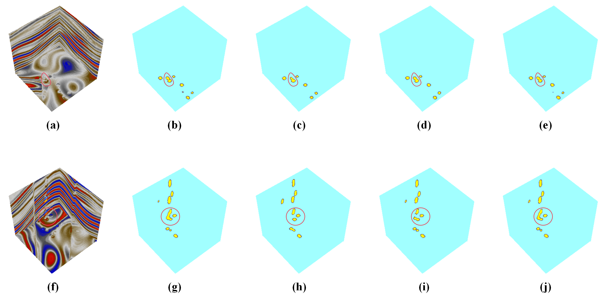
I designed an edge-aware 3D U-Net component using gradient-guided spatial attention, 3D PixelUnshuffle, and SE channel reweighting. The aim is to retain fine cave-boundary information during downsampling.
A composite objective combines Focal Loss, boundary-aware weighted BCE, and gradient consistency. Training, baseline comparisons, block-wise field inference, and interactive visualization form the segmentation workflow.
Team-led data governance and inversion
Under my coordination, the data-governance work combined outlier handling, missing-value processing, resampling, and alignment of heterogeneous geological measurements.
The inversion module combined Bayesian constraints, deep learning, and semi-supervised learning to estimate elastic parameters. This team contribution complements geometric target detection with subsurface property information.